 ICECAP 2 aims to measure the topography (the shape and features of rocks), geology and hydrology of the last unexplored landmass on the planet - Princess Elizabeth Land in East Antarctica. It does this using airborne geophysics to ’see’ under the ice, revealing the rock the lies beneath.
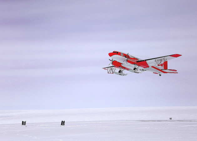
Using a Basler BT-76 aircraft, equipped with an ice-penetrating radar, gravity meter, magnetometer and lidar altimeter, we are able to peer through the ice to the land beneath. The radar provides knowledge of the topography and hydrology (including the presence of subglacial lakes). The gravity meter, in combination with the magnetometer, measure the mass and magnetic properties of the rocks and, in so doing, can allow researchers to infer the geology. The lidar accurately measures the surface profile of the ice sheet.
Building up a map
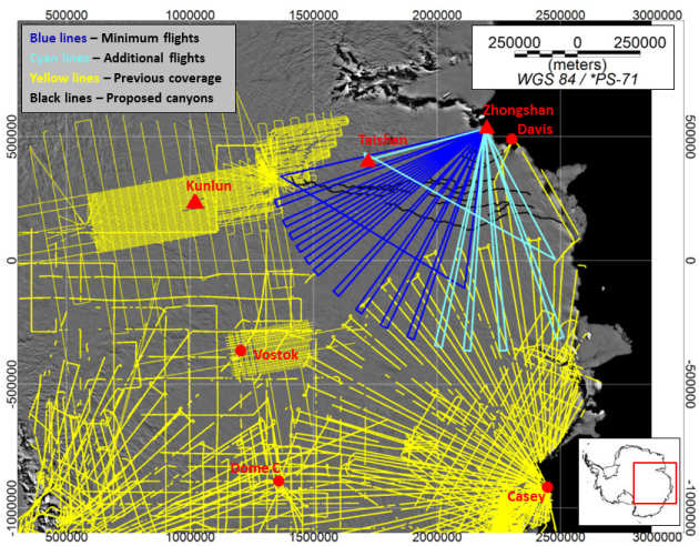
With a series of flights departing from Chinese Research Stations at the coast and inland, we are able to map out the landscape and its physical properties. The work is highly ambitious, complex and difficult given the conditions and remoteness of Princess Elizabeth Land. Several field seasons will be needed to accurately map out the region.