A collaborative research project between Imperial, the British Geological Survey and Centre for Ecology and Hydrology funded under the NERC Flood Risk from Extreme Events (FREE) programme.

Groundwater Flooding in the Pang Catchment 2001
INTRODUCTION
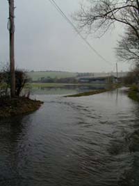
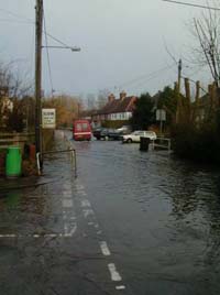
Groundwater flooding is caused by the emergence of water from sub-surface permeable strata, and is often characterised by long flood durations that can cause prolonged disruption and relatively high damage. Extensive groundwater flooding occurred in the winter of 2000/1 in South East England and Northern France.
RESPONSE TO RAINFALL
Studies suggest that the flooding was caused by expansion up the valleys of the area where the water table intersects the ground. The total rainfall during the seven month period from October 2000 to April 2001 was the highest since records began in 1885, whilst individual rainfall events during this period were not exceptional. However, other observations, notably following the very intense rainfall events in summer of 2007 (90m mm in 12 hours), show that a water table which is tens of metres below the surface can respond very rapidly to individual rainfall events, which implies another possible flooding mechanism. These different modes of response are typically attributed to the dual permeability nature of the Chalk unsaturated zone.
FLOOD RISK ASSESSMENT
Probabilistic approaches to flood risk assessment are unlikely to be suitable for groundwater flooding (Table 1). Furthermore, conventional groundwater models are not designed to predict flooding, and tend to have an inadequate temporal resolution; an inadequate representation of the surface elevation; inadequate representation of recharge/the role of the unsaturated zone; and an inadequate representation of groundwater-surface water interactions. Therefore, there are currently no suitable risk assessment tools.
Contact us
Ms Judith Barritt
Tel: +44 (0)20 7594 5967
Email: J.barritt@imperial.ac.uk
EWRE General Office (Room 230),
Department of Civil and Environmental Engineering.
